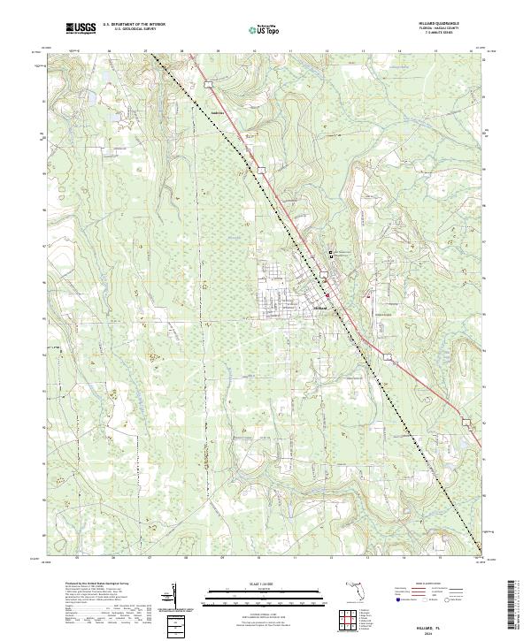
2024 Map of Hilliard
USGS Topo · Published 2024About this map
Hilliard serves as the central hub of this North Florida landscape, where the town's grid meets the diagonal path of Railroad St and the Hilliard Airpark. The area's settlement pattern is defined by these transportation corridors, which navigate the extensive wetlands that surround the community. Significant hydrological features including Little Saint Marys River, Cabbage Swamp, and Buford Bay illustrate the low-lying, water-rich environment of Nassau County. Genealogists and local historians will find the location of Oakwood Cem and Saint Theresa Cem useful for documenting early families. Small clusters of development at Andrews and along various rural roads like Kings Ferry Rd show how the region remains shaped by its timber and river heritage, with drainage from Pigeon Creek and Mills Creek feeding the larger river systems that once drove the local economy.
Find a feature on this map
103 named features on this map. Tap any name to fly to it.
Don’t see what you’re looking for? This feature index may not catch every label — zoom into the map to look around manually.
Map Details
Editions of this 2024 Hilliard Map
This is the sole edition of this map. No revisions or reprints were ever made.
Other maps of this area

1917 · Boulogne
USGS Topo · 1:62,500

1917 · Hilliard
USGS Topo · 1:62,500

1918 · Folkston
USGS Topo · 1:62,500

1918 · Moniac
USGS Topo · 1:62,500

1919 · Hilliard
USGS Topo · 1:62,500

1919 · Boulogne
USGS Topo · 1:62,500

1942 · Moniac
USGS Topo · 1:62,500

1948 · Jacksonville
USGS Topo · 1:250,000

1954 · Valdosta
USGS Topo · 1:250,000

1957 · Jacksonville
USGS Topo · 1:250,000