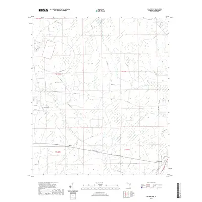
2021 Map of Hilliard SW
USGS Topo · Published 2021About this map
Crawford and Kent anchor this corner of Nassau County, where the landscape is defined by a dense network of creek systems and historical overland routes. The drainage of Alligator Cr and its tributaries, including Little Mills Cr and Funks Cr, create a complex hydrologic pattern across the terrain. Of particular interest to local historians are the established paths like the Old Alachua Trl and Old Alabama Trl, which suggest long-standing corridors of movement through these flatlands. The contemporary landscape is a mix of rural residential development and agricultural activity, evidenced by names like Wright Dairy Rd and Cracker House Ln. These labels, alongside various private lanes and secondary roads like Co RD 108, reveal the modern parceling of land around the perennial wetlands and creek bottoms that have historically shaped settlement in this part of Florida.
Find a feature on this map
56 named features on this map. Tap any name to fly to it.
Don’t see what you’re looking for? This feature index may not catch every label — zoom into the map to look around manually.
Map Details
Editions of this 2021 Hilliard SW Map
This is the sole edition of this map. No revisions or reprints were ever made.
Other maps of this area

1917 · Cambon
USGS Topo · 1:62,500

1917 · Macclenny
USGS Topo · 1:62,500

1917 · Hilliard
USGS Topo · 1:62,500

1918 · Moniac
USGS Topo · 1:62,500

1918 · Cambon
USGS Topo · 1:62,500

1918 · Macclenny
USGS Topo · 1:62,500

1919 · Hilliard
USGS Topo · 1:62,500

1942 · Moniac
USGS Topo · 1:62,500

1948 · Jacksonville
USGS Topo · 1:250,000

1954 · Valdosta
USGS Topo · 1:250,000