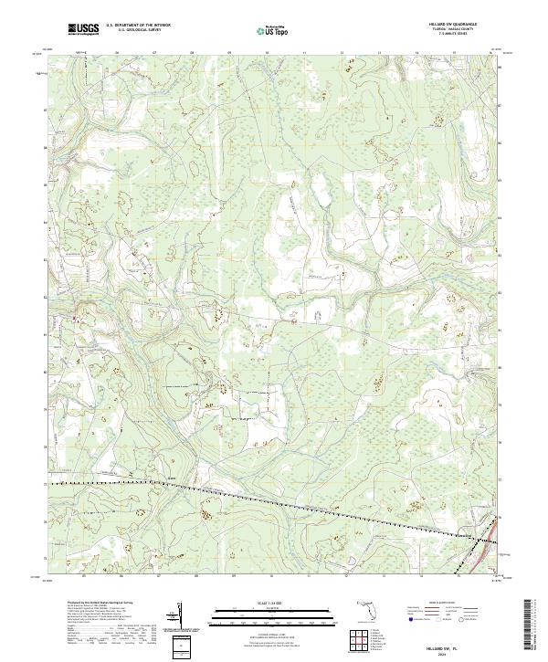
2024 Map of Hilliard SW
USGS Topo · Published 2024About this map
The settlement of Kent sits along a network of county roads and historic corridors in this corner of Nassau County, where the landscape is defined by a dense system of wetlands and slow-moving waterways. Numerous creeks, including Deep Creek, Mill Creek, and Alligator Creek, drain through the territory, reflecting the traditional hydrology of the Florida lowlands. This modern survey shows a rural environment where land use is characterized by timber tracts and recreational areas like the Alligator Creek Hunting Club.
Find a feature on this map
62 named features on this map. Tap any name to fly to it.
Don’t see what you’re looking for? This feature index may not catch every label — zoom into the map to look around manually.
Map Details
Editions of this 2024 Hilliard SW Map
This is the sole edition of this map. No revisions or reprints were ever made.
Other maps of this area

1917 · Cambon
USGS Topo · 1:62,500

1917 · Macclenny
USGS Topo · 1:62,500

1917 · Hilliard
USGS Topo · 1:62,500

1918 · Moniac
USGS Topo · 1:62,500

1918 · Cambon
USGS Topo · 1:62,500

1918 · Macclenny
USGS Topo · 1:62,500

1919 · Hilliard
USGS Topo · 1:62,500

1942 · Moniac
USGS Topo · 1:62,500

1948 · Jacksonville
USGS Topo · 1:250,000

1954 · Valdosta
USGS Topo · 1:250,000