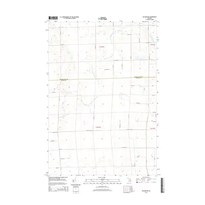
2014 Map of Hillman NE
USGS Topo · Published 2014About this map
North Branch Thunder Bay River and its numerous tributaries, including Quinn Cr and Gaffney Cr, define the drainage patterns across this section of Northern Michigan. The landscape is characterized by the jurisdictional boundary between Presque Isle and Alpena Counties, cutting horizontally through a grid of rural routes and township lines. Local travel is facilitated by a network of named highways and roads such as Mud Lake Hwy, Cedar Hwy, and Hagensville Rd, which reflect the early settlement patterns of the region. The map provides a detailed view of the township and range system, specifically within t33n r5e and t32n r5e, showing how the land was partitioned for agricultural and timber use. Smaller landmarks like Reider School Rd hint at the historic locations of former community centers in this sparsely populated area.
Find a feature on this map
46 named features on this map. Tap any name to fly to it.
Don’t see what you’re looking for? This feature index may not catch every label — zoom into the map to look around manually.
Map Details
Editions of this 2014 Hillman NE Map
This is the sole edition of this map. No revisions or reprints were ever made.
Other maps of this area

1954 · Alpena
USGS Topo · 1:250,000

1955 · Hillman
USGS Topo · 1:62,500

1957 · Alpena
USGS Topo · 1:250,000

1958 · Alpena
USGS Topo · 1:250,000

1969 · Alpena
USGS Topo · 1:250,000

1971 · Hawks
USGS Topo · 1:24,000

1971 · Metz
USGS Topo · 1:24,000

1971 · Polaski
USGS Topo · 1:24,000
1971 · Posen
USGS Topo · 1:24,000

1971 · Lachine
USGS Topo · 1:24,000