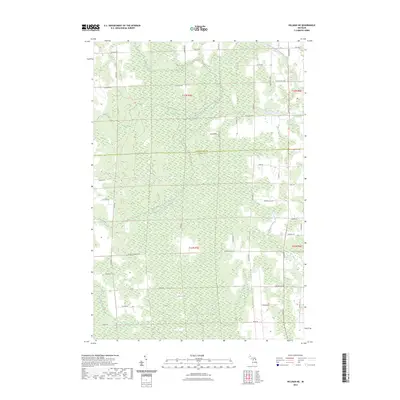
2023 Map of Hillman NE
USGS Topo · Published 2023About this map
The North Branch Thunder Bay River meanders through this landscape on the boundary of Presque Isle and Alpena Counties. This area of Northern Michigan is characterized by extensive wetlands and seasonal watercourses, most notably the expansive Long Swamp in the southern reaches. The map reveals a grid-like network of rural transit, with local history preserved in road names like Reider School Rd, hinting at former centers of local education and community life.
Find a feature on this map
50 named features on this map. Tap any name to fly to it.
Don’t see what you’re looking for? This feature index may not catch every label — zoom into the map to look around manually.
Map Details
Editions of this 2023 Hillman NE Map
This is the sole edition of this map. No revisions or reprints were ever made.
Other maps of this area

1954 · Alpena
USGS Topo · 1:250,000

1955 · Hillman
USGS Topo · 1:62,500

1957 · Alpena
USGS Topo · 1:250,000

1958 · Alpena
USGS Topo · 1:250,000

1969 · Alpena
USGS Topo · 1:250,000

1971 · Hawks
USGS Topo · 1:24,000

1971 · Metz
USGS Topo · 1:24,000

1971 · Polaski
USGS Topo · 1:24,000
1971 · Posen
USGS Topo · 1:24,000

1971 · Lachine
USGS Topo · 1:24,000