
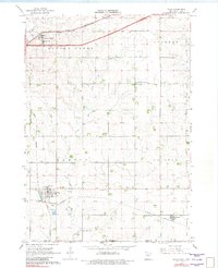
1967 Map of Hills
USGS Topo · Published 1968About this map
The town of Hills serves as a focal point in the southwestern corner of Rock County, where the plains of Minnesota meet the Iowa state line. In the late 1960s, this agricultural landscape was defined by the intersection of two major rail lines: the Chicago and North Western running through the northern township of Beaver Creek, and the Illinois Central serving Hills and Steen to the south. These railways anchored the rural economy, providing essential transport for the scattered farmsteads and the local Gravel Pit.
Find a feature on this map
24 named features on this map. Tap any name to fly to it.
Don’t see what you’re looking for? This feature index may not catch every label — zoom into the map to look around manually.
Map Details
Editions of this 1967 Hills Map
2 editions found
Other maps of this area

1955 · Sioux Falls
USGS Topo · 1:250,000

1958 · Sioux Falls
USGS Topo · 1:250,000

1967 · Valley Springs
USGS Topo · 1:24,000

1967 · Garretson East
USGS Topo · 1:24,000

1967 · Hills NE
USGS Topo · 1:24,000

1967 · Ash Creek
USGS Topo · 1:24,000
1967 · Luverne
USGS Topo · 1:24,000

1971 · Lester
USGS Topo · 1:24,000
1971 · Larchwood
USGS Topo · 1:24,000

1971 · Rock Rapids
USGS Topo · 1:24,000