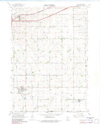
1967 Map of Hills
USGS Topo · Published 1982About this map
The agricultural landscape of Rock County at the Minnesota-Iowa border reveals a dense network of early transportation and rural institutions. Three major rail lines crisscross the terrain, including the Chicago and North Western in the north and the Illinois Central serving the southern settlements of Hills and Steen. These small towns were established as vital grain and trade hubs for the surrounding prairie farmsteads.
Find a feature on this map
26 named features on this map. Tap any name to fly to it.
Don’t see what you’re looking for? This feature index may not catch every label — zoom into the map to look around manually.
Map Details
Editions of this 1967 Hills Map
2 editions found
Other maps of this area

1955 · Sioux Falls
USGS Topo · 1:250,000

1958 · Sioux Falls
USGS Topo · 1:250,000

1967 · Valley Springs
USGS Topo · 1:24,000

1967 · Garretson East
USGS Topo · 1:24,000

1967 · Hills
USGS Topo · 1:24,000

1967 · Hills NE
USGS Topo · 1:24,000

1967 · Ash Creek
USGS Topo · 1:24,000
1967 · Luverne
USGS Topo · 1:24,000

1971 · Lester
USGS Topo · 1:24,000
1971 · Larchwood
USGS Topo · 1:24,000