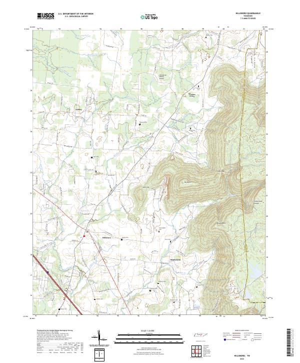
2022 Map of Hillsboro
USGS Topo · Published 2022About this map
Hillsboro and Stephenson sit at the western edge of the rising Cumberland Plateau, where the flat valley lands meet the complex drainage systems of the Tennessee Valley Divide. The landscape is defined by the transition from open agricultural fields to the intricate topography of the plateau, characterized by features like Henry Cove, Lusk Cove, and Long Cove. Numerous family-named landmarks and cemeteries, such as Gentry Cem and Crockett Cem, are scattered throughout the region, reflecting generations of local history and rural settlement patterns. The area is heavily intersected by small waterways like Bradley Cr and Blue Spring Cr, which carve through the terrain beneath landmarks like Big Butte. Significant local infrastructure, including the Cumberland Academy Rd and several historic cemetery sites, provides a detailed map of the social and geographic layout of this portion of Coffee County.
Find a feature on this map
117 named features on this map. Tap any name to fly to it.
Don’t see what you’re looking for? This feature index may not catch every label — zoom into the map to look around manually.
Map Details
Editions of this 2022 Hillsboro Map
This is the sole edition of this map. No revisions or reprints were ever made.
Other maps of this area

1893 · Mc Minnville
USGS Topo · 1:125,000

1895 · Mc Minnville
USGS Topo · 1:125,000

1895 · Sewanee
USGS Topo · 1:125,000

1913 · Hollow Springs
USGS Topo · 1:62,500

1936 · Alto
USGS Topo · 1:24,000

1936 · Fredonia
USGS Topo · 1:24,000

1936 · Manchester
USGS Topo · 1:24,000

1936 · Burrow Cove
USGS Topo · 1:24,000

1936 · Morrison
USGS Topo · 1:24,000

1936 · Hillsboro
USGS Topo · 1:24,000