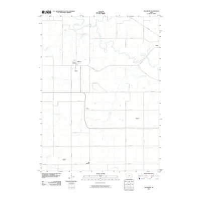
2010 Map of Hillsboro
USGS Topo · Published 2010About this map
The settlement of Hillsboro serves as the central hub of this agricultural landscape in Henry County, Iowa. The town plan is anchored by the Hillsboro Post Office and the nearby Hillsboro Cemetery, reflecting a long-established community structure. The surrounding countryside is defined by an intricate network of waterways, including the winding paths of Cedar Creek, Rock Creek, and Little Cedar Creek. To the southeast, the small community of Big Mound and the distant edge of Salem frame the map's rural extent.
Find a feature on this map
40 named features on this map. Tap any name to fly to it.
Don’t see what you’re looking for? This feature index may not catch every label — zoom into the map to look around manually.
Map Details
Editions of this 2010 Hillsboro Map
This is the sole edition of this map. No revisions or reprints were ever made.
Other maps of this area

1958 · Burlington
USGS Topo · 1:250,000

1961 · Burlington
USGS Topo · 1:250,000

1963 · Burlington
USGS Topo · 1:250,000

1968 · Bonaparte
USGS Topo · 1:24,000

1968 · Donnellson
USGS Topo · 1:24,000

1968 · Farmington
USGS Topo · 1:24,000

1980 · Lockridge West
USGS Topo · 1:24,000

1980 · Lockridge East
USGS Topo · 1:24,000

1981 · Mount Pleasant
USGS Topo · 1:24,000
1981 · Salem
USGS Topo · 1:24,000