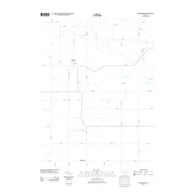
2013 Map of Hillsboro
USGS Topo · Published 2013About this map
The town of Hillsboro serves as the central hub of this Iowa landscape, where the local street grid intersects with historical thoroughfares like Salem Rd and Henry Van Buren Ave. To the south, the settlement of Big Mound anchors the rural countryside near the headwaters of Sugar Cr. The map reveals a complex drainage pattern defined by the winding course of Little Cedar Cr, which snakes across the territory alongside its tributaries, Mud Cr and Rock Cr. This 2013 topographic survey captures the enduring rural character of Henry County, illustrating how modern section roads such as Yellow Ave and Dakota Ave follow the rectilinear patterns established during the original land surveys, even as they navigate the meandering banks of Cedar Cr.
Find a feature on this map
44 named features on this map. Tap any name to fly to it.
Don’t see what you’re looking for? This feature index may not catch every label — zoom into the map to look around manually.
Map Details
Editions of this 2013 Hillsboro Map
This is the sole edition of this map. No revisions or reprints were ever made.
Other maps of this area

1958 · Burlington
USGS Topo · 1:250,000

1961 · Burlington
USGS Topo · 1:250,000

1963 · Burlington
USGS Topo · 1:250,000

1968 · Bonaparte
USGS Topo · 1:24,000

1968 · Donnellson
USGS Topo · 1:24,000

1968 · Farmington
USGS Topo · 1:24,000

1980 · Lockridge West
USGS Topo · 1:24,000

1980 · Lockridge East
USGS Topo · 1:24,000

1981 · Mount Pleasant
USGS Topo · 1:24,000
1981 · Salem
USGS Topo · 1:24,000