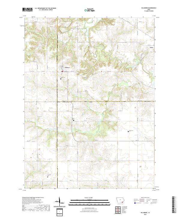
2022 Map of Hillsboro
USGS Topo · Published 2022About this map
Hillsboro serves as the primary hub of this rural landscape where the borders of Henry, Van Buren, and Lee Counties converge. The settlement pattern follows a grid of gravel and paved roads including Salem Rd and Agency Rd, which connect the town to nearby Salem and the surrounding agricultural tracts. This 2022 survey documents a terrain deeply etched by a network of drainage systems, most notably Cedar Creek and its namesake, Little Cedar Cr, alongside Sugar Cr and Rock Cr. For genealogists and local historians, the map preserves the exact locations of several burial grounds that anchor the area's rural history, including Hillsboro Cem, Wallingford Cem, and Bayles Cem. The placement of these cemeteries, often near watercourses like Reeds Cr, provides a clear view of the longstanding relationship between the region's topography and its early family settlements.
Find a feature on this map
57 named features on this map. Tap any name to fly to it.
Don’t see what you’re looking for? This feature index may not catch every label — zoom into the map to look around manually.
Map Details
Editions of this 2022 Hillsboro Map
This is the sole edition of this map. No revisions or reprints were ever made.
Other maps of this area

1958 · Burlington
USGS Topo · 1:250,000

1961 · Burlington
USGS Topo · 1:250,000

1963 · Burlington
USGS Topo · 1:250,000

1968 · Bonaparte
USGS Topo · 1:24,000

1968 · Donnellson
USGS Topo · 1:24,000

1968 · Farmington
USGS Topo · 1:24,000

1980 · Lockridge West
USGS Topo · 1:24,000

1980 · Lockridge East
USGS Topo · 1:24,000

1981 · Mount Pleasant
USGS Topo · 1:24,000
1981 · Salem
USGS Topo · 1:24,000