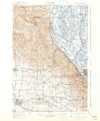
1918 Map of Hillsboro
USGS Topo · Published 1943About this map
Sauvie Island and the confluence of the Columbia River and Willamette River anchor this topographic survey. The landscape transitions from the river-bottom lakes like Sturgeon Lake and Mouse Island Lake to the agricultural plains and foothills west of Portland. A dense network of early 20th-century transportation defines the region, including the Spokane Portland and Seattle Railway and the Oregon Electric Railway, which served burgeoning communities such as Hillsboro, Orenco, and North Plains.
Find a feature on this map
113 named features on this map. Tap any name to fly to it.
Don’t see what you’re looking for? This feature index may not catch every label — zoom into the map to look around manually.
Map Details
Editions of this 1918 Hillsboro Map
4 editions found
Other maps of this area

1897 · Portland
USGS Topo · 1:62,500

1905 · Portland
USGS Topo · 1:62,500

1914 · Oregon City
USGS Topo · 1:62,500

1915 · Hillsboro
USGS Topo · 1:62,500

1916 · Tualatin
USGS Topo · 1:62,500

1918 · Hillsboro
USGS Topo · 1:62,500

1922 · St. Helens
USGS Topo · 1:62,500

1939 · Oregon City
USGS Topo · 1:62,500

1939 · Tualatin
USGS Topo · 1:62,500

1940 · Tualatin
USGS Topo · 1:62,500