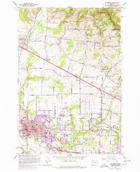
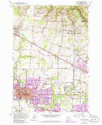
1961 Map of Hillsboro
USGS Topo · Published 1977About this map
Hillsboro serves as a bustling hub in the Tualatin Valley during the early 1960s, its urban grid and Hillsboro Airport surrounded by fertile plains and emerging suburban communities. The landscape is deeply tied to its pioneer heritage, evidenced by the Historical Marker Joseph L Meek Land Claim and the old West Union Ch. Local infrastructure is anchored by the County Fairgrounds and several neighborhood schools like B W Barnes Sch and Mooberry Sch.
Find a feature on this map
65 named features on this map. Tap any name to fly to it.
Don’t see what you’re looking for? This feature index may not catch every label — zoom into the map to look around manually.
Map Details
Editions of this 1961 Hillsboro Map
5 editions found
Other maps of this area

1915 · Hillsboro
USGS Topo · 1:62,500

1916 · Tualatin
USGS Topo · 1:62,500

1918 · Hillsboro
USGS Topo · 1:62,500

1939 · Tualatin
USGS Topo · 1:62,500

1940 · Tualatin
USGS Topo · 1:62,500

1940 · Hillsboro
USGS Topo · 1:62,500

1941 · Gales Creek
USGS Topo · 1:62,500

1941 · Yamhill
USGS Topo · 1:62,500

1942 · Yamhill
USGS Topo · 1:62,500

1948 · Vancouver
USGS Topo · 1:250,000