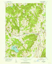
1953 Map of Hillsdale
USGS Topo · Published 1955About this map
Hillsdale and the surrounding Columbia County landscape are defined by the winding course of the Roeliff Jansen Kill and the path of the New York Central railroad in the mid-1950s. This survey illustrates a rural New York economy transitioning from a rail-dependent agricultural network to a mid-century residential and recreational era. The eastern edge of the map shows the beginnings of Taconic State Park, while local landmarks like the Roeliff Jansen Sch and Drum Church anchor the social geography of the time. The terrain is marked by distinctive elevations such as Lyon Mountain and Pumpkin Hill, which separate the smaller hamlets of North Hillsdale and Craryville. Detailed water features including Copake Lake with its Mosquito Island and several smaller ponds like Goose Pond provide a clear view of the area's hydrology before later development altered these rural corridors.
Find a feature on this map
35 named features on this map. Tap any name to fly to it.
Don’t see what you’re looking for? This feature index may not catch every label — zoom into the map to look around manually.
Map Details
Editions of this 1953 Hillsdale Map
Other maps of this area

1885 · Sheffield
USGS Topo · 1:62,500

1888 · Sheffield
USGS Topo · 1:62,500

1888 · Pittsfield
USGS Topo · 1:62,500

1890 · Pittsfield
USGS Topo · 1:62,500

1891 · Sheffield
USGS Topo · 1:62,500

1893 · Sheffield
USGS Topo · 1:62,500

1893 · Pittsfield
USGS Topo · 1:62,500

1894 · Pittsfield
USGS Topo · 1:62,500

1897 · Pittsfield
USGS Topo · 1:62,500

1897 · Sheffield
USGS Topo · 1:62,500