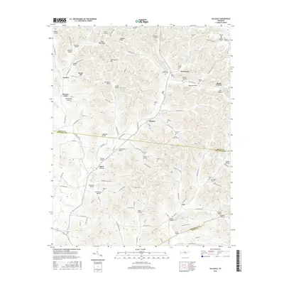
2016 Map of Hillsdale
USGS Topo · Published 2016About this map
Hillsdale and Meadorville anchor this survey of the hill country where Macon, Trousdale, and Smith counties converge. The landscape is defined by an intricate network of hollows and ridges, such as Hard Scratch Hill and Peddlers Ridge, which shaped the early development of small communities like New Harmony and Beech Hill. The map reveals a deeply rooted rural society, evidenced by dozens of family-named burial grounds including Lovelady Cem, the Nelson-McDonald Cem, and the Meador Family Cem.
Find a feature on this map
136 named features on this map. Tap any name to fly to it.
Don’t see what you’re looking for? This feature index may not catch every label — zoom into the map to look around manually.
Map Details
Editions of this 2016 Hillsdale Map
This is the sole edition of this map. No revisions or reprints were ever made.
Other maps of this area

1931 · Lafayette
USGS Topo · 1:62,500

1931 · Red Boiling Springs
USGS Topo · 1:62,500

1932 · Carthage
USGS Topo · 1:62,500

1956 · Corbin
USGS Topo · 1:250,000

1956 · Nashville
USGS Topo · 1:250,000

1958 · Corbin
USGS Topo · 1:250,000

1958 · Westmoreland
USGS Topo · 1:24,000

1958 · Bellwood
USGS Topo · 1:24,000

1958 · Dixon Springs
USGS Topo · 1:24,000
1958 · Lafayette
USGS Topo · 1:24,000