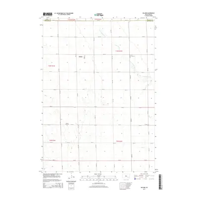
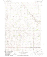
2015 Map of Hillside
USGS Topo · Published 2015About this map
Hillside sits at the heart of this agricultural landscape in southeastern South Dakota, where the survey reveals a strictly organized grid of section lines and gravel roads. This rural community in Douglas County is defined by its deep-rooted spiritual and family ties, evidenced by the high density of burial grounds distributed across the townships. From Saint John Cem near the town site to Friedhof Cem and Roberts Chapel Cem further afield, these landmarks serve as the primary anchors for genealogical research in an area otherwise dominated by open fields. The terrain is subtly carved by intermittent drainage systems, including the S Fork Twelvemile Cr and Coffee Cr, which provided essential water sources for early farmsteads. The map clearly delineates the border between Davison and Douglas counties, illustrating how political boundaries shaped the development of this prairie region.
Find a feature on this map
30 named features on this map. Tap any name to fly to it.
Don’t see what you’re looking for? This feature index may not catch every label — zoom into the map to look around manually.
Map Details
Editions of this 2015 Hillside Map
This is the sole edition of this map. No revisions or reprints were ever made.
Other maps of this area

1899 · Mitchell
USGS Topo · 1:125,000

1955 · Mitchell
USGS Topo · 1:250,000

1959 · Mitchell
USGS Topo · 1:250,000

1979 · Delmont
USGS Topo · 1:24,000
1979 · Delmont NE
USGS Topo · 1:24,000
1979 · Delmont SE
USGS Topo · 1:24,000
1979 · Armour
USGS Topo · 1:24,000
1979 · Hillside
USGS Topo · 1:24,000

1980 · Corsica Lake
USGS Topo · 1:24,000

1980 · Old Stickney Lake
USGS Topo · 1:24,000