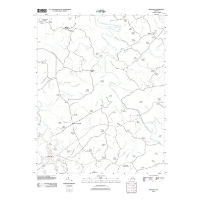
2010 Map of Hillsville
USGS Topo · Published 2010About this map
Hillsville and its surrounding Carroll County countryside are defined by a network of family-named cemeteries and rural crossroads in this 2010 survey. Settlements such as Mabry Crossroads, Mitchell Crossroads, and Liberty Hill anchor the landscape, which is deeply etched by the winding course of Big Reed Island Creek and its many tributaries, including Buckhorn Creek and Little Snake Creek. The abundance of burial grounds, such as the John Patterson Webb Cemetery, Carter-Wilkerson Cemetery, and Montgomery-Smith Cemetery, provides a dense map of local genealogy and legacy families. High points like Witcher Knob and Huffman Knob rise above the valleys, while the Longshoal Lookout Tower stands as a prominent landmark on the northern ridge. The transportation network is a mix of older routes and newer infrastructure, represented by the William D Tomkins Memorial Bridge and the forested retreat of Camp Virginian.
Find a feature on this map
94 named features on this map. Tap any name to fly to it.
Don’t see what you’re looking for? This feature index may not catch every label — zoom into the map to look around manually.
Map Details
Editions of this 2010 Hillsville Map
This is the sole edition of this map. No revisions or reprints were ever made.
Other maps of this area

1889 · Hillsville
USGS Topo · 1:125,000

1892 · Hillsville
USGS Topo · 1:125,000

1896 · Hillsville
USGS Topo · 1:125,000

1930 · Max Meadows
USGS Topo · 1:62,500

1931 · Galax
USGS Topo · 1:48,000

1933 · Galax
USGS Topo · 1:62,500

1953 · Winston-Salem
USGS Topo · 1:250,000

1955 · Winston-Salem
USGS Topo · 1:250,000

1956 · Macks Mountain
USGS Topo · 1:62,500

1957 · Mount Airy
USGS Topo · 1:62,500