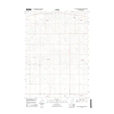
2015 Map of Hilltop Diamond Ring Ranch
USGS Topo · Published 2015About this map
Hilltop Diamond Ring Ranch sits in the high plains of Haakon County, illustrating a landscape defined by expansive ranching operations and a sparse network of section-line roads. The drainage patterns of Plum Cr, Cottonwood Cr, and Burnt Cr carve the terrain, dictating the placement of early 21st-century rural infrastructure. This area reflects the enduring homesteading legacy of western South Dakota, where family-named landmarks and remote burial sites such as Mattison Cem serve as primary anchors for local history and genealogy. The map details the transition between township ranges, including t4n r23e and t5n r24e, showing how modern county roads like Ottumwa Rd and Teaney Rd follow the rigid grid of the Public Land Survey System while navigating the natural breaks and coulees.
Find a feature on this map
25 named features on this map. Tap any name to fly to it.
Don’t see what you’re looking for? This feature index may not catch every label — zoom into the map to look around manually.
Map Details
Editions of this 2015 Hilltop Diamond Ring Ranch Map
This is the sole edition of this map. No revisions or reprints were ever made.
Other maps of this area

1954 · Pierre
USGS Topo · 1:250,000

1958 · Pierre
USGS Topo · 1:250,000

1982 · Midland NW
USGS Topo · 1:24,000

1982 · May Ranch
USGS Topo · 1:24,000

1983 · Bentley Ranch
USGS Topo · 1:24,000

1983 · Mule Creek
USGS Topo · 1:24,000

1983 · Philip
USGS Topo · 1:100,000

1983 · Moenville
USGS Topo · 1:24,000

1983 · Middle Draw
USGS Topo · 1:24,000

1983 · Powell NW
USGS Topo · 1:24,000