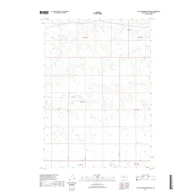
2017 Map of Hilltop Diamond Ring Ranch
USGS Topo · Published 2017About this map
Hilltop Diamond Ring Ranch sits in the open rangeland of Haakon County, where the high plains are carved by intermittent drainage systems. This 2017 survey details a landscape defined by ranching and section-line roads like Ottumwa Rd and Teaney Rd, which navigate the subtle topography between the Cheyenne and Bad Rivers. Of particular interest to genealogists and local historians is the Mattison Cem, a small burial site located west of 238th Ave. The terrain is characterized by several major drainages, including Cottonwood Cr, Plum Cr, Mule Cr, and Burnt Cr, which dictate the placement of stock ponds and remote ranch infrastructure. The map reveals the modern rural layout of the region, where the Public Land Survey System continues to organize the vast open spaces of central South Dakota.
Find a feature on this map
21 named features on this map. Tap any name to fly to it.
Don’t see what you’re looking for? This feature index may not catch every label — zoom into the map to look around manually.
Map Details
Editions of this 2017 Hilltop Diamond Ring Ranch Map
This is the sole edition of this map. No revisions or reprints were ever made.
Other maps of this area

1954 · Pierre
USGS Topo · 1:250,000

1958 · Pierre
USGS Topo · 1:250,000

1982 · Midland NW
USGS Topo · 1:24,000

1982 · May Ranch
USGS Topo · 1:24,000

1983 · Bentley Ranch
USGS Topo · 1:24,000

1983 · Mule Creek
USGS Topo · 1:24,000

1983 · Philip
USGS Topo · 1:100,000

1983 · Moenville
USGS Topo · 1:24,000

1983 · Middle Draw
USGS Topo · 1:24,000

1983 · Powell NW
USGS Topo · 1:24,000