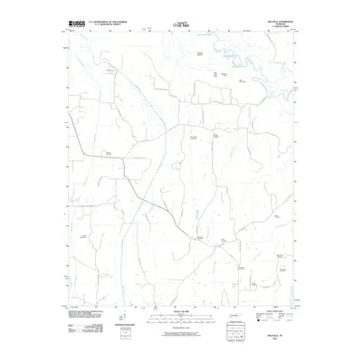
2010 Map of Hillville
USGS Topo · Published 2010About this map
The Hatchie River and its wide, meandering floodplain at Hatchie Bottom define the northern reaches of this landscape. The river’s shifting course is evident in features like Horseshoe Lake and the Horseshoe Cutoff, marking the dynamic nature of the drainage system. This area is characterized by a high density of rural burial grounds, including the Harmony Cemetery, Mount Pleasant Cemetery, and the closely situated Old Cauley Cemetery and New Cauley Cemetery.
Find a feature on this map
59 named features on this map. Tap any name to fly to it.
Don’t see what you’re looking for? This feature index may not catch every label — zoom into the map to look around manually.
Map Details
Editions of this 2010 Hillville Map
This is the sole edition of this map. No revisions or reprints were ever made.
Other maps of this area

1950 · Sunnyhill
USGS Topo · 1:24,000

1950 · Brownsville
USGS Topo · 1:24,000

1951 · Brownsville
USGS Topo · 1:24,000

1951 · Sunnyhill
USGS Topo · 1:24,000

1952 · Dancyville
USGS Topo · 1:24,000

1952 · Laconia
USGS Topo · 1:24,000

1952 · Stanton
USGS Topo · 1:62,500

1956 · Blytheville
USGS Topo · 1:250,000

1959 · Blytheville
USGS Topo · 1:250,000

1959 · Denmark
USGS Topo · 1:24,000