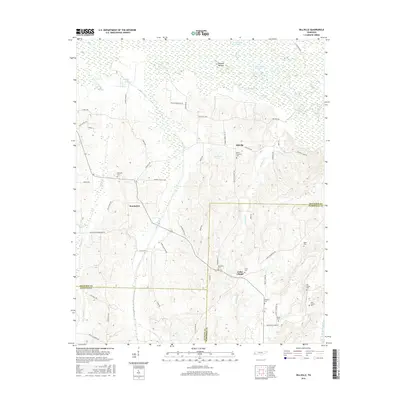
2016 Map of Hillville
USGS Topo · Published 2016About this map
The Hatchie River and its expansive Hatchie Bottom dominate the northern landscape of this region, where the river's winding path has created numerous oxbows like Horseshoe Lake and the Horseshoe Cutoff. This wetland environment gives way to a network of small agricultural settlements and rural communities concentrated in the center and south, including Hillville, Cedar Chapel, and Eurekaton.
Find a feature on this map
79 named features on this map. Tap any name to fly to it.
Don’t see what you’re looking for? This feature index may not catch every label — zoom into the map to look around manually.
Map Details
Editions of this 2016 Hillville Map
This is the sole edition of this map. No revisions or reprints were ever made.
Other maps of this area

1950 · Sunnyhill
USGS Topo · 1:24,000

1950 · Brownsville
USGS Topo · 1:24,000

1951 · Brownsville
USGS Topo · 1:24,000

1951 · Sunnyhill
USGS Topo · 1:24,000

1952 · Dancyville
USGS Topo · 1:24,000

1952 · Laconia
USGS Topo · 1:24,000

1952 · Stanton
USGS Topo · 1:62,500

1956 · Blytheville
USGS Topo · 1:250,000

1959 · Blytheville
USGS Topo · 1:250,000

1959 · Denmark
USGS Topo · 1:24,000