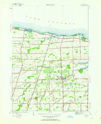
1952 Map of Hilton
USGS Topo · Published 1963About this map
Lake Ontario defines the northern reaches of this mid-century survey, where a series of seasonal and year-round lakeside communities like Shore Acres, Wautoma Beach, and Lighthouse Beach line the shore. Inland, the village of Hilton serves as the primary hub, surrounded by a transition from fruit orchards to rural homesteads. The landscape is carved by several waterways, including Salmon Creek and West Creek, which dictate the placement of early farm roads and bridge crossings.
Find a feature on this map
47 named features on this map. Tap any name to fly to it.
Don’t see what you’re looking for? This feature index may not catch every label — zoom into the map to look around manually.
Map Details
Editions of this 1952 Hilton Map
3 editions found
Other maps of this area

1895 · Rochester
USGS Topo · 1:62,500

1895 · Ontario Beach
USGS Topo · 1:62,500

1898 · Rochester
USGS Topo · 1:62,500

1899 · Hamlin
USGS Topo · 1:62,500

1899 · Ontario Beach
USGS Topo · 1:62,500

1899 · Brockport
USGS Topo · 1:62,500

1912 · Rochester
USGS Topo · 1:62,500

1912 · Ontario Beach
USGS Topo · 1:62,500

1920 · Rochester
USGS Topo · 1:62,500

1931 · Rochester West
USGS Topo · 1:24,000