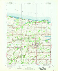
1952 Map of Hilton
USGS Topo · Published 1970About this map
Lake Ontario shorelines define the northern edge of this Monroe County landscape, where a string of seasonal and permanent waterfront settlements like Benedict Beach and Lighthouse Beach sit tucked behind the Hogback ridge. Further inland, the village of Hilton serves as the primary hub, situated where the Penn Central railroad tracks cross Salmon Creek. The map documents a dense network of early 20th-century education and community life, preserved through numerous schoolhouse locations such as School No 12, School No 5, and School No 9. Agricultural and transit history is visible in the transition from rural crossroads like Bartlett Corners and Collamer to mid-century developments like the Hilton Airport and various landing strips. Local waterways including West Creek and Moorman Creek cut through the townships of Hamlin, Parma, and Clarkson, illustrating the drainage patterns that shaped the area's farming layout.
Find a feature on this map
51 named features on this map. Tap any name to fly to it.
Don’t see what you’re looking for? This feature index may not catch every label — zoom into the map to look around manually.
Map Details
Editions of this 1952 Hilton Map
3 editions found
Other maps of this area

1895 · Rochester
USGS Topo · 1:62,500

1895 · Ontario Beach
USGS Topo · 1:62,500

1898 · Rochester
USGS Topo · 1:62,500

1899 · Hamlin
USGS Topo · 1:62,500

1899 · Ontario Beach
USGS Topo · 1:62,500

1899 · Brockport
USGS Topo · 1:62,500

1912 · Rochester
USGS Topo · 1:62,500

1912 · Ontario Beach
USGS Topo · 1:62,500

1920 · Rochester
USGS Topo · 1:62,500

1931 · Rochester West
USGS Topo · 1:24,000