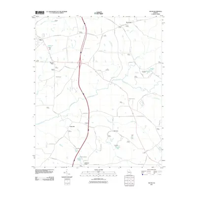
2011 Map of Hilyer
USGS Topo · Published 2011About this map
Smiths Mill and the surrounding agricultural landscape of Troup County are defined by a dense network of family-named landmarks and water resources. The terrain is crisscrossed by several prominent waterways, including Flat Shoal Creek, Turkey Creek, and Mud Creek, which feed into local reservoirs like Ouvre Lake, Floyd Lake, and Champion Lake. The presence of the LaGrange Quarry in the north suggests the importance of resource extraction to the local economy, while the naming of small communities like Big Springs, Oak Grove, and Pleasant Grove reflects a legacy of dispersed rural settlements. For genealogists, the map is particularly rich, documenting numerous small burial grounds such as the McGee Cemetery, Sledge Cemetery, and Murphy Cemetery, often located near their namesake homesteads. This configuration of family cemeteries and small crossroads settlements like Andersons Corner provides a clear view of the traditional land-use patterns before modern development intensified.
Find a feature on this map
82 named features on this map. Tap any name to fly to it.
Don’t see what you’re looking for? This feature index may not catch every label — zoom into the map to look around manually.
Map Details
Editions of this 2011 Hilyer Map
This is the sole edition of this map. No revisions or reprints were ever made.
Other maps of this area

1899 · Wedowee
USGS Topo · 1:125,000

1902 · Wedowee
USGS Topo · 1:125,000

1907 · Talbotton
USGS Topo · 1:125,000

1907 · Opelika
USGS Topo · 1:125,000

1909 · Opelika
USGS Topo · 1:125,000

1953 · Atlanta
USGS Topo · 1:250,000

1955 · Phenix City
USGS Topo · 1:250,000

1957 · Phenix City
USGS Topo · 1:250,000

1957 · Atlanta
USGS Topo · 1:250,000

1958 · Phenix City
USGS Topo · 1:250,000