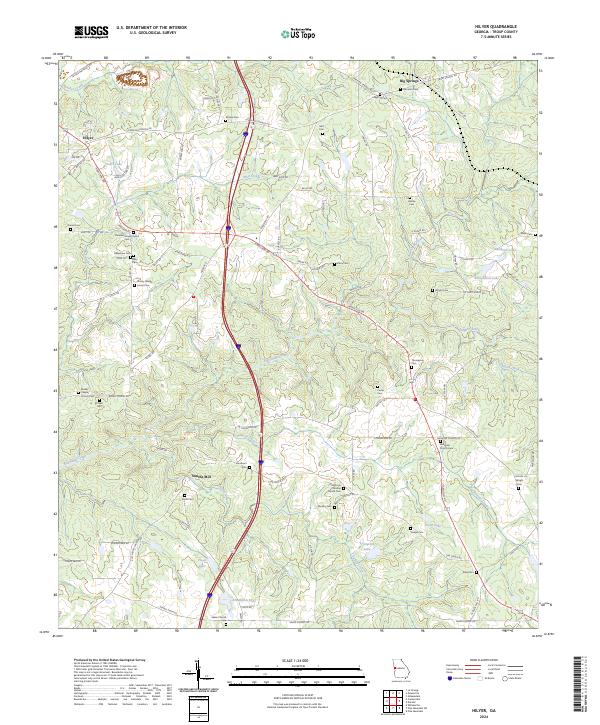
2024 Map of Hilyer
USGS Topo · Published 2024About this map
Smiths Mill and the surrounding Georgia countryside are defined by a complex network of small cemeteries and rural congregations that trace the family lineages of Troup County. The landscape is carved by Flat Shoal Creek and Polecat Creek, which drain the undulating terrain into several small impoundments such as Livingston Lake and Floyd Lake. This 2024 survey captures the persistent rural character of the region, from the settlement at Hilyer in the northwest to the community of Big Springs in the northeast. Numerous family-named burial grounds, including the Rakestraw Cem, McGee Cem, and Shirley Sledge Junior Cem, provide a dense record of local genealogy. Long-standing religious centers like Pleasant Grove Church and Ebenezer Church remain central landmarks amidst the timbered tracts and winding routes like Hamilton Rd.
Find a feature on this map
97 named features on this map. Tap any name to fly to it.
Don’t see what you’re looking for? This feature index may not catch every label — zoom into the map to look around manually.
Map Details
Editions of this 2024 Hilyer Map
This is the sole edition of this map. No revisions or reprints were ever made.
Other maps of this area

1899 · Wedowee
USGS Topo · 1:125,000

1902 · Wedowee
USGS Topo · 1:125,000

1907 · Talbotton
USGS Topo · 1:125,000

1907 · Opelika
USGS Topo · 1:125,000

1909 · Opelika
USGS Topo · 1:125,000

1953 · Atlanta
USGS Topo · 1:250,000

1955 · Phenix City
USGS Topo · 1:250,000

1957 · Phenix City
USGS Topo · 1:250,000

1957 · Atlanta
USGS Topo · 1:250,000

1958 · Phenix City
USGS Topo · 1:250,000