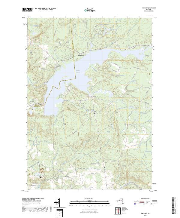
2023 Map of Hinckley
USGS Topo · Published 2023About this map
Hinckley Reservoir dominates this landscape on the border of Oneida and Herkimer Counties, its expansive waters submerging much of the valley between Northwood and Hinckley. The map details the rural character of the West Canada Creek valley, where small communities like Grant and Russia remain anchored by a network of county roads and historical burial grounds such as Woodin Corners Cem and Century Cem. The settlement pattern follows the drainage of numerous small brooks, including Buttermilk Brook and Taynter Brook, which feed the larger reservoir system. Moving south toward Gravesville, the terrain transitions into the distinct Elm Flats and the protected marshes of Shepard Swamp, illustrating a landscape shaped by both early industrial water management and natural wetlands. This 2023 survey provides a contemporary record of these long-standing rural hamlets and their relationship to the central hydrography of the region.
Find a feature on this map
104 named features on this map. Tap any name to fly to it.
Don’t see what you’re looking for? This feature index may not catch every label — zoom into the map to look around manually.
Map Details
Editions of this 2023 Hinckley Map
This is the sole edition of this map. No revisions or reprints were ever made.
Other maps of this area

1897 · Remsen
USGS Topo · 1:62,500

1898 · Utica
USGS Topo · 1:62,500

1900 · Little Falls
USGS Topo · 1:62,500

1900 · Utica
USGS Topo · 1:62,500

1900 · Remsen
USGS Topo · 1:62,500

1900 · Wilmurt
USGS Topo · 1:62,500

1902 · Wilmurt
USGS Topo · 1:62,500

1903 · Little Falls
USGS Topo · 1:62,500

1939 · Little Falls
USGS Topo · 1:62,500

1943 · Newport
USGS Topo · 1:24,000