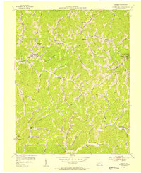
1954 Map of Hindman
USGS Topo · Published 1955About this map
Hindman serves as the central hub of this eastern Kentucky mountain landscape, where the confluence of Troublesome Creek and its many branches dictates the pattern of settlement. Compiled in part from coal company maps, this mid-century survey reveals a dense network of valley-floor communities and hollow-side institutions. The eastern portion of the sheet is dominated by educational landmarks, specifically the campus of Caney Junior College and Caney High School near the community of Pippa Passes.
Find a feature on this map
69 named features on this map. Tap any name to fly to it.
Don’t see what you’re looking for? This feature index may not catch every label — zoom into the map to look around manually.
Map Details
Editions of this 1954 Hindman Map
2 editions found
Other maps of this area

1890 · Whitesburg
USGS Topo · 1:125,000

1891 · Hazard
USGS Topo · 1:125,000

1892 · Whitesburg
USGS Topo · 1:125,000

1912 · Hindman
USGS Topo · 1:48,000

1913 · Oven Fork
USGS Topo · 1:48,000

1914 · Troublesome
USGS Topo · 1:62,500

1915 · Hindman
USGS Topo · 1:62,500

1915 · Whitesburg
USGS Topo · 1:62,500

1916 · Cornettsville
USGS Topo · 1:62,500
1954 · Vest
USGS Topo · 1:24,000