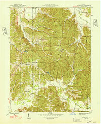
1948 Map of Hindustan
USGS Topo · Published 1948About this map
The Hindustan settlement and the wooded ridges of the Morgan-Monroe State Forest define this landscape in the late 1940s. Situated at the convergence of several deep-cut valleys and ridges such as Mason Ridge and Persimmon Ridge, the area shows a pattern of upland homesteads and valley floor farming. Religious life and community burial grounds are well-documented throughout the terrain, including Taylor Cem, Stepp Cem, and the Bethany Temple. The northern path of the Illinois Central railroad cuts through the southern reaches near Bean Blossom Creek, while many smaller water bodies like Bryant Creek Lake and Bean Blossom Lake provide localized water sources. A prominent Fire Tower sits atop the high ground of Meetinghouse Ridge, overlooking a network of hollows like Deadman Hollow and Happy Hollow.
Find a feature on this map
56 named features on this map. Tap any name to fly to it.
Don’t see what you’re looking for? This feature index may not catch every label — zoom into the map to look around manually.
Map Details
Editions of this 1948 Hindustan Map
3 editions found
Other maps of this area

1908 · Bloomington
USGS Topo · 1:48,000

1910 · Bloomington
USGS Topo · 1:62,500

1942 · Franklin
USGS Topo · 1:125,000

1946 · Belmont
USGS Topo · 1:24,000

1947 · Unionville
USGS Topo · 1:24,000

1948 · Hindustan
USGS Topo · 1:24,000

1948 · Morgantown
USGS Topo · 1:24,000

1950 · Belmont
USGS Topo · 1:24,000

1950 · Morgantown
USGS Topo · 1:24,000

1953 · Indianapolis
USGS Topo · 1:250,000