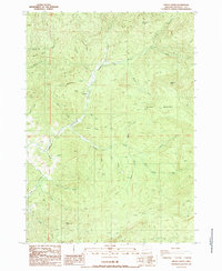
1987 Map of Hinkle Creek
USGS Topo · Published 1987About this map
Calapooya Creek and its many tributaries carve through this Douglas County landscape, reflecting the intensive timber and transport history of the region in the late twentieth century. The map centers on the small settlement of Hawthorne, positioned along the Calapooya Grade. This corridor, along with the Old RR Grade, points to the historical importance of mountain transit and logging infrastructure in moving resources through the steep drainages of Hinkle Creek and Beaty Creek.
Find a feature on this map
38 named features on this map. Tap any name to fly to it.
Don’t see what you’re looking for? This feature index may not catch every label — zoom into the map to look around manually.
Map Details
Editions of this 1987 Hinkle Creek Map
This is the sole edition of this map. No revisions or reprints were ever made.
Other maps of this area

1897 · Roseburg
USGS Topo · 1:125,000

1900 · Roseburg
USGS Topo · 1:125,000

1935 · Lowell
USGS Topo · 1:96,000

1942 · Lowell
USGS Topo · 1:125,000

1954 · Anlauf
USGS Topo · 1:62,500

1954 · Glide
USGS Topo · 1:62,500

1955 · Mace Mtn
USGS Topo · 1:62,500

1955 · Culp Creek
USGS Topo · 1:62,500

1958 · Roseburg
USGS Topo · 1:250,000

1959 · Roseburg
USGS Topo · 1:250,000