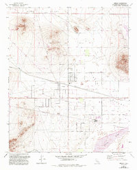
1971 Map of Hinkley
USGS Topo · Published 1993About this map
Hinkley sits at the heart of this Mojave Desert landscape, serving as a hub for both agricultural and industrial activity during the latter half of the 20th century. The settlement is anchored by the Hinkley Sch and Hinkley PO, with the Atchison Topeka and Santa Fe railroad corridor defining the community's orientation. The map reveals an intricate infrastructure of pipelines and a Pumping Sta, reflecting the critical importance of water management in the arid Hinkley Valley.
Find a feature on this map
45 named features on this map. Tap any name to fly to it.
Don’t see what you’re looking for? This feature index may not catch every label — zoom into the map to look around manually.
Map Details
Editions of this 1971 Hinkley Map
3 editions found
Other maps of this area

1915 · Searles Lake
USGS Topo · 1:250,000

1932 · Barstow
USGS Topo · 1:125,000

1934 · Barstow
USGS Topo · 1:125,000

1947 · Trona
USGS Topo · 1:250,000

1948 · Trona
USGS Topo · 1:250,000

1953 · San Bernardino
USGS Topo · 1:250,000

1953 · Trona
USGS Topo · 1:250,000

1955 · Opal Mountain
USGS Topo · 1:62,500

1956 · San Bernardino
USGS Topo · 1:250,000

1956 · Fremont Peak
USGS Topo · 1:62,500