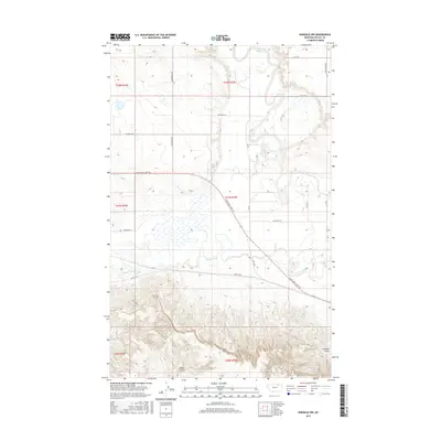
2017 Map of Hinsdale NW
USGS Topo · Published 2017About this map
The Milk River meanders through the northern reaches of this Valley County landscape, defining a riparian corridor that contrasts sharply with the elevated terrain to the south. This area is characterized by the transition from the river valley to the prominent Larb Hills, where the geography becomes increasingly complex with drainage features like McNab Coulee and Limekiln Coulee. The historical significance of the region is underscored by the Lewis and Clark Trl, which traverses the central section of the map, providing a tangible link to early western exploration.
Find a feature on this map
24 named features on this map. Tap any name to fly to it.
Don’t see what you’re looking for? This feature index may not catch every label — zoom into the map to look around manually.
Map Details
Editions of this 2017 Hinsdale NW Map
This is the sole edition of this map. No revisions or reprints were ever made.
Other maps of this area

1905 · Saco Special
USGS Topo · 1:62,500

1906 · Hinsdale Special Map
USGS Topo · 1:62,500

1954 · Glasgow
USGS Topo · 1:250,000

1957 · Glasgow
USGS Topo · 1:250,000

1958 · Glasgow
USGS Topo · 1:250,000

1984 · Bjornberg Bridge
USGS Topo · 1:24,000

1984 · Double S Hill
USGS Topo · 1:24,000
1984 · Jones Coulee
USGS Topo · 1:24,000

1984 · Ashford Coulee
USGS Topo · 1:24,000
1984 · Saco
USGS Topo · 1:24,000