
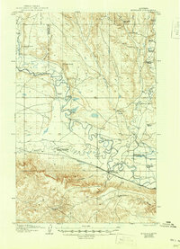
1906 Map of Hinsdale Special Map
USGS Topo · Published 1906About this map
Hinsdale serves as the central hub of this northern Montana landscape, situated where the Great Northern R R parallels the winding course of the Milk River. The settlement pattern of the early twentieth century is defined by a dense network of family-named ranch holdings scattered across the coulees and creek drainages. Notable operations include Nelson's Ranch and Smeder's Ranch in the north, while the southern reaches feature Kepple's Ranch near Tank Coulee.
Find a feature on this map
38 named features on this map. Tap any name to fly to it.
Don’t see what you’re looking for? This feature index may not catch every label — zoom into the map to look around manually.
Map Details
Editions of this 1906 Hinsdale Special Map Map
2 editions found
Other maps of this area

1905 · Saco Special
USGS Topo · 1:62,500

1919 · Boundary
USGS Topo · 1:125,000

1943 · Glasgow
USGS Topo · 1:125,000

1954 · Glasgow
USGS Topo · 1:250,000

1957 · Glasgow
USGS Topo · 1:250,000

1958 · Glasgow
USGS Topo · 1:250,000

1969 · Vandalia
USGS Topo · 1:24,000

1969 · Ellsworth Coulee
USGS Topo · 1:24,000

1984 · Bjornberg Bridge
USGS Topo · 1:24,000

1984 · Double S Hill
USGS Topo · 1:24,000