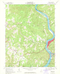
1968 Map of Hinton
USGS Topo · Published 1971About this map
The confluence of the New River and the Greenbrier River dominates this 1968 landscape, marking the civic heart of Hinton. The town serves as a critical rail hub, where the Chesapeake and Ohio tracks expand to accommodate significant riverfront traffic. To the south, the massive Bluestone Dam holds back the waters of Bluestone Lake, a centerpiece of the Bluestone State Park.
Find a feature on this map
58 named features on this map. Tap any name to fly to it.
Don’t see what you’re looking for? This feature index may not catch every label — zoom into the map to look around manually.
Map Details
Editions of this 1968 Hinton Map
2 editions found
Other maps of this area

1887 · Hinton
USGS Topo · 1:125,000

1891 · Raleigh
USGS Topo · 1:125,000

1892 · Hinton
USGS Topo · 1:125,000

1897 · Raleigh
USGS Topo · 1:125,000

1902 · Raleigh
USGS Topo · 1:125,000

1911 · Flattop
USGS Topo · 1:48,000

1911 · Beckley
USGS Topo · 1:48,000

1912 · Meadow Creek
USGS Topo · 1:48,000

1912 · Big Bend
USGS Topo · 1:62,500

1913 · Beckley
USGS Topo · 1:62,500