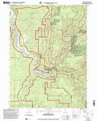
1997 Map of Hiouchi
USGS Topo · Published 2001About this map
The Smith River and its designated Wild and Scenic River status define this northern California landscape, where the confluence of the Middle and South Forks creates a hub for river access and forest management. The settlement of Hiouchi serves as a central point between major protected lands, including Jedediah Smith Redwoods State Park and Redwood National Park. Land use reflects a transition from extraction to recreation, evidenced by the Lind Mine and the historical Nickerson Ranch (Site) alongside modern facilities like the Del Norte Golf Course. Numerous river entry points, such as Peacock Bridge River Access and The Forks River Access, illustrate the region's 1990s focus on water-based activities within the Six Rivers National Forest Recreation Area.
Find a feature on this map
45 named features on this map. Tap any name to fly to it.
Don’t see what you’re looking for? This feature index may not catch every label — zoom into the map to look around manually.
Map Details
Editions of this 1997 Hiouchi Map
This is the sole edition of this map. No revisions or reprints were ever made.
Other maps of this area

1922 · Preston Peak
USGS Topo · 1:125,000

1929 · Crescent City
USGS Topo · 1:125,000

1945 · Ship Mountain
USGS Topo · 1:62,500

1945 · Gasquet
USGS Topo · 1:62,500

1945 · Point St. George
USGS Topo · 1:62,500

1945 · Requa
USGS Topo · 1:62,500

1948 · Weed
USGS Topo · 1:250,000

1949 · Eureka
USGS Topo · 1:250,000

1950 · Weed
USGS Topo · 1:250,000

1951 · Gasquet
USGS Topo · 1:62,500