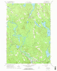
1964 Map of Hiram
USGS Topo · Published 1966About this map
The Saco River meanders through the heart of this landscape, its wide bends and adjacent wetlands like Pequawket Pond and Burbank Pond defining the local geography. In the mid-1960s, the Maine Central Railroad followed the river's path, serving the settlements of Hiram and East Hiram. This era shows a community deeply tied to its hills and water, with small villages like Denmark and West Denmark interconnected by a network of local roads and the Beaver Trail.
Find a feature on this map
74 named features on this map. Tap any name to fly to it.
Don’t see what you’re looking for? This feature index may not catch every label — zoom into the map to look around manually.
Map Details
Editions of this 1964 Hiram Map
2 editions found
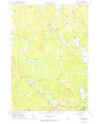
Other maps of this area

1896 · Norway
USGS Topo · 1:62,500

1896 · Sebago
USGS Topo · 1:62,500

1909 · Fryeburg
USGS Topo · 1:62,500

1910 · Kezar Falls
USGS Topo · 1:48,000

1911 · Fryeburg
USGS Topo · 1:62,500

1911 · Kezar Falls
USGS Topo · 1:62,500

1941 · Fryeburg
USGS Topo · 1:62,500

1942 · Sebago Lake
USGS Topo · 1:62,500

1943 · Sebago Lake
USGS Topo · 1:62,500

1946 · Norway
USGS Topo · 1:62,500