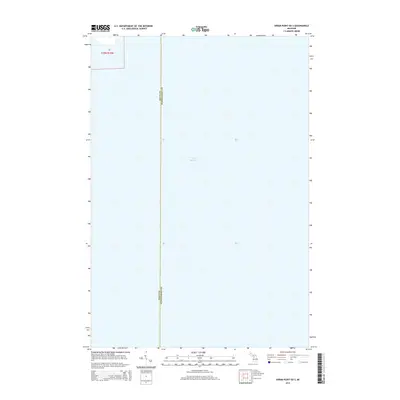
2014 Map of Hiram Point OE S
USGS Topo · Published 2014About this map
Lake Michigan dominates this maritime survey, illustrating the vast open waters of the northern Great Lakes region. The map focuses on a segment of the lake where the administrative boundary between Delta Co and Schoolcraft Co runs north to south through the water. Only a small portion of the Upper Peninsula landmass is visible in the northwest corner, identified as part of Section 26, Township 39 North, Range 18 West. This 2014 edition serves as a clear record of the modern hydrography and county borders in the waters off the Garden Peninsula, providing essential geographic data for nautical history or regional boundary research.
Find a feature on this map
3 named features on this map. Tap any name to fly to it.
Don’t see what you’re looking for? This feature index may not catch every label — zoom into the map to look around manually.
Map Details
Editions of this 2014 Hiram Point OE S Map
This is the sole edition of this map. No revisions or reprints were ever made.
Other maps of this area

1932 · Burnt Bluff NE
USGS Topo · 1:31,680

1932 · Garden SE
USGS Topo · 1:31,680

1954 · Escanaba
USGS Topo · 1:250,000

1957 · Escanaba
USGS Topo · 1:250,000

1958 · Escanaba
USGS Topo · 1:250,000

1958 · Cooks
USGS Topo · 1:62,500

1958 · Garden
USGS Topo · 1:62,500

1958 · Fairport
USGS Topo · 1:62,500

1983 · Manistique
USGS Topo · 1:100,000
1983 · Point Aux Barques
USGS Topo · 1:25,000