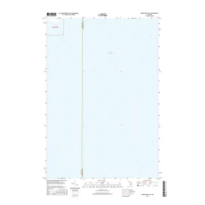
2017 Map of Hiram Point OE S
USGS Topo · Published 2017About this map
Lake Michigan dominates this aquatic landscape, representing the offshore waters where the jurisdictional boundaries of the Upper Peninsula meet. The map documents the precise north-south maritime border separating Delta Co and Schoolcraft Co. While the vast majority of the sheet covers open water, a small terrestrial fragment of Township 39 North, Range 18 West appears in the northwest corner, providing a tiny anchor for property and land management records in this coastal region. The lack of terrestrial features emphasizes the maritime nature of this specific location, where the lake serves as both a physical barrier and a primary geographic feature of the Great Lakes system.
Find a feature on this map
3 named features on this map. Tap any name to fly to it.
Don’t see what you’re looking for? This feature index may not catch every label — zoom into the map to look around manually.
Map Details
Editions of this 2017 Hiram Point OE S Map
This is the sole edition of this map. No revisions or reprints were ever made.
Other maps of this area

1932 · Burnt Bluff NE
USGS Topo · 1:31,680

1932 · Garden SE
USGS Topo · 1:31,680

1954 · Escanaba
USGS Topo · 1:250,000

1957 · Escanaba
USGS Topo · 1:250,000

1958 · Escanaba
USGS Topo · 1:250,000

1958 · Cooks
USGS Topo · 1:62,500

1958 · Garden
USGS Topo · 1:62,500

1958 · Fairport
USGS Topo · 1:62,500

1983 · Manistique
USGS Topo · 1:100,000
1983 · Point Aux Barques
USGS Topo · 1:25,000