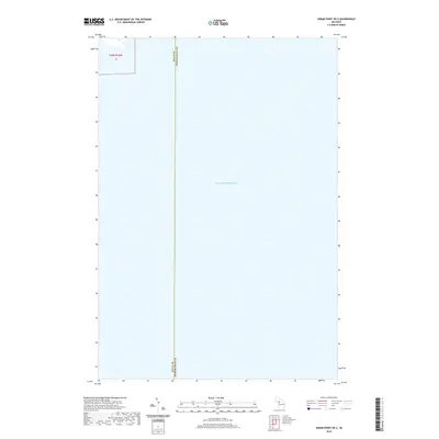
2019 Map of Hiram Point OE S
USGS Topo · Published 2019About this map
Lake Michigan dominates this coastal survey, where the waters meet the southern reaches of Michigan's Upper Peninsula. The map highlights a significant administrative boundary where Delta Co and Schoolcraft Co converge along a straight north-south line extending into the lake. This 2019 edition focuses primarily on the maritime expanse and the subtle interface of the coastline within t39n r18w, Section 26. The lack of inland development at this specific point emphasizes the open aquatic landscape and the precise delineation of county jurisdictions over the water, providing a modern record of these borders as they stood in the late 2010s.
Find a feature on this map
4 named features on this map. Tap any name to fly to it.
Don’t see what you’re looking for? This feature index may not catch every label — zoom into the map to look around manually.
Map Details
Editions of this 2019 Hiram Point OE S Map
This is the sole edition of this map. No revisions or reprints were ever made.
Other maps of this area

1932 · Burnt Bluff NE
USGS Topo · 1:31,680

1932 · Garden SE
USGS Topo · 1:31,680

1954 · Escanaba
USGS Topo · 1:250,000

1957 · Escanaba
USGS Topo · 1:250,000

1958 · Escanaba
USGS Topo · 1:250,000

1958 · Cooks
USGS Topo · 1:62,500

1958 · Garden
USGS Topo · 1:62,500

1958 · Fairport
USGS Topo · 1:62,500

1983 · Manistique
USGS Topo · 1:100,000
1983 · Point Aux Barques
USGS Topo · 1:25,000