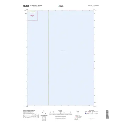
2023 Map of Hiram Point OE S
USGS Topo · Published 2023About this map
Lake Michigan dominates this coastal survey, which captures the open water and shoreline interface along the southern reach of the Garden Peninsula. The map focuses almost entirely on the offshore environment, with only a small fragment of terrestrial land appearing in the northwest corner within Township 39 North, Range 18 West, Section 26. This layout emphasizes the importance of maritime navigation and bathymetry in a region where the land gives way to the deep waters of the Great Lakes. The lack of terrestrial infrastructure or settlements reflects the specialized purpose of this nautical-focused sheet, illustrating the transition from the rugged shoreline of the Upper Peninsula into the expanse of the lake.
Find a feature on this map
2 named features on this map. Tap any name to fly to it.
Don’t see what you’re looking for? This feature index may not catch every label — zoom into the map to look around manually.
Map Details
Editions of this 2023 Hiram Point OE S Map
This is the sole edition of this map. No revisions or reprints were ever made.
Other maps of this area

1932 · Burnt Bluff NE
USGS Topo · 1:31,680

1932 · Garden SE
USGS Topo · 1:31,680

1954 · Escanaba
USGS Topo · 1:250,000

1957 · Escanaba
USGS Topo · 1:250,000

1958 · Escanaba
USGS Topo · 1:250,000

1958 · Cooks
USGS Topo · 1:62,500

1958 · Garden
USGS Topo · 1:62,500

1958 · Fairport
USGS Topo · 1:62,500

1983 · Manistique
USGS Topo · 1:100,000
1983 · Point Aux Barques
USGS Topo · 1:25,000