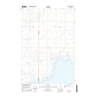
2014 Map of Hiram Point
USGS Topo · Published 2014About this map
Lake Michigan dominates the southern reaches of this survey, where the rugged Upper Peninsula coastline is defined by prominent landmarks like Hiram Point, Point O'Keefe, and Cole Point. The interior landscape is a complex network of wetlands and small water bodies, including Bursaw Marsh and numerous glacial lakes such as Lake Thirteen and Halfway Lake. The boundary between Delta and Schoolcraft Counties runs vertically through the center, marking a transition in the local infrastructure. Along the shoreline, human activity is concentrated near Little Harbor and the Farley Grave Site, while the hinterlands are accessed by a grid of logging and local routes like Garden Grade Rd and Goldmine Rd. This shoreline geography, with its various inlets like Parent Bay, reflects a landscape historically shaped by both the timber industry and the lake's maritime influence.
Find a feature on this map
34 named features on this map. Tap any name to fly to it.
Don’t see what you’re looking for? This feature index may not catch every label — zoom into the map to look around manually.
Map Details
Editions of this 2014 Hiram Point Map
This is the sole edition of this map. No revisions or reprints were ever made.
Other maps of this area

1931 · Cooks NE
USGS Topo · 1:31,680

1931 · Cooks NW
USGS Topo · 1:31,680

1932 · Burnt Bluff NE
USGS Topo · 1:31,680

1932 · Garden SE
USGS Topo · 1:31,680

1932 · Garden NE
USGS Topo · 1:31,680

1954 · Escanaba
USGS Topo · 1:250,000

1957 · Escanaba
USGS Topo · 1:250,000

1958 · Escanaba
USGS Topo · 1:250,000

1958 · Cooks
USGS Topo · 1:62,500

1958 · Garden
USGS Topo · 1:62,500