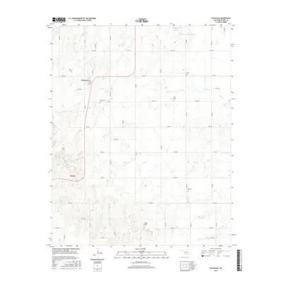
2016 Map of Hitchcock
USGS Topo · Published 2016About this map
Hitchcock serves as the primary hub of this Blaine County landscape, where the town layout is defined by Broadway and 1st St. The surrounding countryside is organized by a rigorous section-line road grid, characteristic of the Oklahoma plains, with routes like E0720 Rd and N2630 Rd connecting outlying homesteads and community sites. For genealogists, the map is particularly detailed, identifying several rural burial grounds including Winnview Cem, Cottonwood Cem, Saint John's Cem, and Cooper Cem. The terrain is marked by gentle drainage systems such as Willow Cr and Otter Cr, which flow through the prairie toward small impoundments like the Tonkawa Creek Site 101 Reservoir. The small settlement at Bucher and the landmark at Cedar Knoll further distinguish this agricultural region during the early twenty-first century.
Find a feature on this map
38 named features on this map. Tap any name to fly to it.
Don’t see what you’re looking for? This feature index may not catch every label — zoom into the map to look around manually.
Map Details
Editions of this 2016 Hitchcock Map
This is the sole edition of this map. No revisions or reprints were ever made.
Other maps of this area

1893 · Loyal
USGS Topo · 1:62,500

1893 · Ames
USGS Topo · 1:62,500

1955 · Clinton
USGS Topo · 1:250,000

1955 · Woodward
USGS Topo · 1:250,000

1956 · Ames
USGS Topo · 1:62,500

1957 · Clinton
USGS Topo · 1:250,000

1958 · Woodward
USGS Topo · 1:250,000

1972 · Watonga
USGS Topo · 1:24,000
1972 · Omega
USGS Topo · 1:24,000

1972 · Watonga SE
USGS Topo · 1:24,000