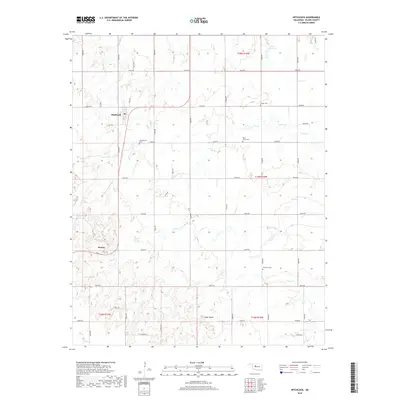
2018 Map of Hitchcock
USGS Topo · Published 2018About this map
Hitchcock serves as the primary settlement in this section of Blaine County, situated within a landscape defined by the regular grid of the Public Land Survey System. The area is characterized by a network of drainage systems, including Otter Cr, Willow Cr, and Cooper Cr, which carve through the plains. Local history is anchored by several rural burying grounds that speak to the early community organization of the region, such as Cottonwood Cem south of town and Saint John's Cem to the east. Further south, the settlement of Bucher sits near the rising elevation of Cedar Knoll. The density of section-line roads like n2620 RD and e0730 RD illustrates the enduring influence of the 19th-century land allotments on the modern Oklahoma landscape, maintaining a rural structure even as individual farmsteads evolved.
Find a feature on this map
40 named features on this map. Tap any name to fly to it.
Don’t see what you’re looking for? This feature index may not catch every label — zoom into the map to look around manually.
Map Details
Editions of this 2018 Hitchcock Map
This is the sole edition of this map. No revisions or reprints were ever made.
Other maps of this area

1893 · Loyal
USGS Topo · 1:62,500

1893 · Ames
USGS Topo · 1:62,500

1955 · Clinton
USGS Topo · 1:250,000

1955 · Woodward
USGS Topo · 1:250,000

1956 · Ames
USGS Topo · 1:62,500

1957 · Clinton
USGS Topo · 1:250,000

1958 · Woodward
USGS Topo · 1:250,000

1972 · Watonga
USGS Topo · 1:24,000
1972 · Omega
USGS Topo · 1:24,000

1972 · Watonga SE
USGS Topo · 1:24,000