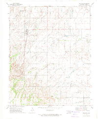
1972 Map of Hitchcock
USGS Topo · Published 1974About this map
The town of Hitchcock serves as the primary hub for this portion of Blaine County, situated along the Chicago Rock Island and Pacific railroad line. The landscape reflects a well-established agricultural and extractive economy in the early 1970s, dotted with numerous gas and oil wells. Evidence of the area's rural social history is found in the distribution of community landmarks, including Cottonwood Cem and St John Cem, as well as the smaller settlement of Busher to the south.
Find a feature on this map
28 named features on this map. Tap any name to fly to it.
Don’t see what you’re looking for? This feature index may not catch every label — zoom into the map to look around manually.
Map Details
Editions of this 1972 Hitchcock Map
This is the sole edition of this map. No revisions or reprints were ever made.
Other maps of this area

1893 · Loyal
USGS Topo · 1:62,500

1893 · Ames
USGS Topo · 1:62,500

1955 · Clinton
USGS Topo · 1:250,000

1955 · Woodward
USGS Topo · 1:250,000

1956 · Ames
USGS Topo · 1:62,500

1957 · Clinton
USGS Topo · 1:250,000

1958 · Woodward
USGS Topo · 1:250,000

1972 · Watonga
USGS Topo · 1:24,000
1972 · Omega
USGS Topo · 1:24,000

1972 · Watonga SE
USGS Topo · 1:24,000