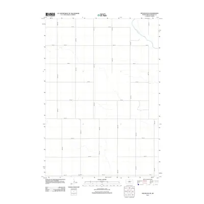
2012 Map of Hitchcock SE
USGS Topo · Published 2012About this map
Broadland anchors the southwestern corner of this survey, representing a quiet agricultural landscape in Beadle County. The terrain is defined by a rigid grid of rural roads, including north-south corridors like 394th Ave and east-west routes such as 199th St. In the far northeast, the James River cuts across the corner of the quadrangle, providing a natural break in the geometric regularity of the section lines. This 2012 snapshot reflects the enduring rural character of the region, where the Broadland Cem serves as a primary historical landmark for those researching local family roots. The map’s focus on precise property-line roads and sparse water features underscores the systematic development of the Dakota prairie.
Find a feature on this map
18 named features on this map. Tap any name to fly to it.
Don’t see what you’re looking for? This feature index may not catch every label — zoom into the map to look around manually.
Map Details
Editions of this 2012 Hitchcock SE Map
This is the sole edition of this map. No revisions or reprints were ever made.
Other maps of this area

1895 · Byron
USGS Topo · 1:125,000

1898 · Huron
USGS Topo · 1:125,000

1953 · Huron
USGS Topo · 1:250,000

1954 · Huron
USGS Topo · 1:250,000

1956 · Lake Byron NW
USGS Topo · 1:24,000

1956 · Lake Byron
USGS Topo · 1:24,000

1956 · Spink Colony
USGS Topo · 1:24,000

1956 · Hitchcock SE
USGS Topo · 1:24,000

1958 · Huron NW
USGS Topo · 1:24,000

1967 · Hitchcock SW
USGS Topo · 1:24,000