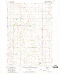
1967 Map of Hitchcock
USGS Topo · Published 1969About this map
Hitchcock serves as the primary hub in this prairie landscape, where the Chicago and North Western railroad cuts a diagonal line across the grid of township boundaries. Surveyed as part of the Department of the Interior's development program for the Missouri River Basin, the topography is defined by subtle depressions and low rises, punctuated by human-made features like the Flowing Well and a Water Tank near the town center. Local history is anchored by the presence of Tulare Cem in the northwest and Graceland Cem to the northeast, offering critical points of reference for genealogists tracing early families in Tulare or Crandon townships. The map also records the rural infrastructure of the late 1960s, including several Gravel Pits and a network of field lines that reveal the agricultural footprint across Belmont and Garfield townships.
Find a feature on this map
14 named features on this map. Tap any name to fly to it.
Don’t see what you’re looking for? This feature index may not catch every label — zoom into the map to look around manually.
Map Details
Editions of this 1967 Hitchcock Map
This is the sole edition of this map. No revisions or reprints were ever made.
Other maps of this area

1895 · Byron
USGS Topo · 1:125,000

1899 · Redfield
USGS Topo · 1:125,000

1953 · Huron
USGS Topo · 1:250,000

1954 · Huron
USGS Topo · 1:250,000

1956 · Glendale Colony
USGS Topo · 1:24,000

1956 · Spink Colony
USGS Topo · 1:24,000

1956 · Hitchcock SE
USGS Topo · 1:24,000

1966 · Redfield South
USGS Topo · 1:24,000

1967 · Frankfort SW
USGS Topo · 1:24,000

1967 · Hitchcock SW
USGS Topo · 1:24,000