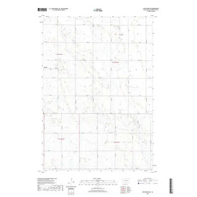
2017 Map of Hitchcock SW
USGS Topo · Published 2017About this map
Bonilla occupies a central role in this northern Beadle County landscape, situated near the intersection of Main St and 387th Ave. The terrain is defined by an intricate network of wetlands and small water bodies that pocket the prairie, shaping the irregular paths of section roads. This 2017 U.S. Geological Survey topographic study illustrates the transition of the Great Plains into a modern grid of agricultural parcels, though several historical markers remain. Genealogy researchers will find interest in the documented locations of Altoona Cem to the northeast and Bonilla Cem just east of the primary settlement. The map reveals how local infrastructure like Co Rd 8 and Co Rd 11 adapts to the natural depressions and marshy ground common to this part of South Dakota.
Find a feature on this map
24 named features on this map. Tap any name to fly to it.
Don’t see what you’re looking for? This feature index may not catch every label — zoom into the map to look around manually.
Map Details
Editions of this 2017 Hitchcock SW Map
This is the sole edition of this map. No revisions or reprints were ever made.
Other maps of this area

1895 · Byron
USGS Topo · 1:125,000

1898 · Huron
USGS Topo · 1:125,000

1899 · Redfield
USGS Topo · 1:125,000

1950 · Wessington NE
USGS Topo · 1:24,000

1953 · Huron
USGS Topo · 1:250,000

1954 · Huron
USGS Topo · 1:250,000

1956 · Spink Colony
USGS Topo · 1:24,000

1956 · Hitchcock SE
USGS Topo · 1:24,000

1967 · Hitchcock SW
USGS Topo · 1:24,000

1967 · Tulare SE
USGS Topo · 1:24,000