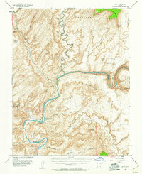
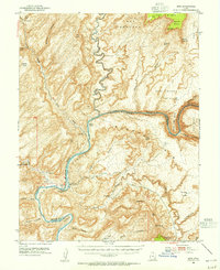
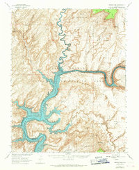
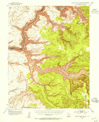
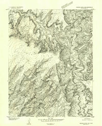
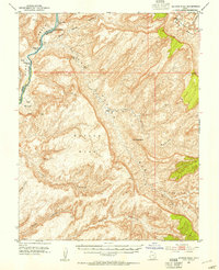
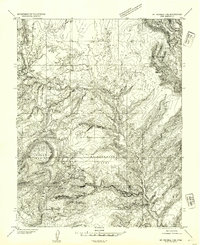
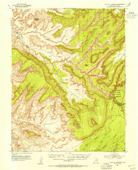
1952 Map of Hite
USGS Topo · Published 1961About this map
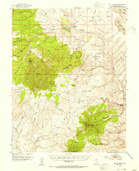
Hite serves as the focal point of this river-cut landscape in the early 1950s, situated at the strategic junction where White Canyon meets the Colorado River. Before the waters of Lake Powell altered the topography, this survey documents the era of the Dandy Crossing (Ferry), one of the few places to traverse the canyon country. The map shows a region of early uranium exploration and isolated settlement, with the Happy Jack Mine and a local Airstrip indicating the growing industrial presence in the San Juan and Garfield County borderlands. The convergence of the Dirty Devil River and the Colorado at Mille Crag Bend highlights the dramatic drainage patterns of Glen Canyon and Cataract Canyon. Cultural history is noted by the presence of Petroglyphs and named landmarks like Grainery Rock, reflecting a long human connection to this high desert environment.
Find a feature on this map
46 named features on this map. Tap any name to fly to it.
Don’t see what you’re looking for? This feature index may not catch every label — zoom into the map to look around manually.
Map Details
Editions of this 1952 Hite Map
3 editions found
Other maps of this area

1885 · San Rafael
USGS Topo · 1:250,000

1886 · Henry Mountains
USGS Topo · 1:250,000

1892 · Henry Mountains
USGS Topo · 1:250,000
1952 · Mouth of Dark Canyon
USGS Topo · 1:62,500
1952 · Orange Cliffs 3 SW
USGS Topo · 1:24,000
1952 · Mancos Mesa
USGS Topo · 1:62,500
1952 · Mt Pennell 1 NE
USGS Topo · 1:24,000
1952 · Natural Bridges
USGS Topo · 1:62,500
1952 · Mt Hillers
USGS Topo · 1:62,500
1952 · Mt Pennell 1 SE
USGS Topo · 1:24,000