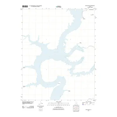
2011 Map of Hite South
USGS Topo · Published 2011About this map
Lake Powell dominates this landscape within Glen Canyon National Park, where the rising reservoir waters fill the deep labyrinthine drainages of the Colorado River basin. The map centers on a significant bend in the lake known as The Horn, flanked by numerous side canyons including Farley Canyon, Twomile Canyon, and Fourmile Canyon. These features illustrate the complex interface between high desert plateaus and the drowned river valley. Near the northern edge of the sheet, the legacy of early river crossings is preserved at Hite (Historical), a site that transformed from a pioneer ferry location into a modern recreation hub featuring the Hite Marina and Hite Marina Campground. Inland, landmarks such as Red Monument rise above the surrounding terrain, while isolated routes like Blue Notch Rd provide rare access into this desert interior.
Find a feature on this map
14 named features on this map. Tap any name to fly to it.
Don’t see what you’re looking for? This feature index may not catch every label — zoom into the map to look around manually.
Map Details
Editions of this 2011 Hite South Map
This is the sole edition of this map. No revisions or reprints were ever made.
Other maps of this area

1886 · Henry Mountains
USGS Topo · 1:250,000

1892 · Henry Mountains
USGS Topo · 1:250,000

1952 · Mancos Mesa
USGS Topo · 1:62,500

1952 · Mt Pennell 1 NE
USGS Topo · 1:24,000

1952 · Mt Hillers
USGS Topo · 1:62,500

1952 · Mt Pennell 1 SE
USGS Topo · 1:24,000

1952 · Hite
USGS Topo · 1:62,500

1953 · Mt Pennell 4 NE
USGS Topo · 1:24,000

1953 · Mt. Ellsworth
USGS Topo · 1:62,500
1954 · White Canyon 2 NE
USGS Topo · 1:24,000