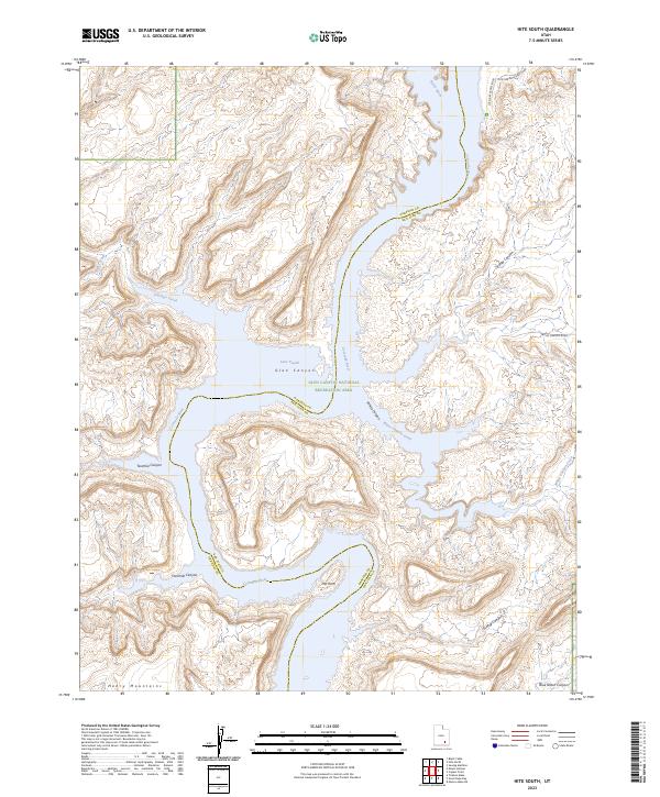
2023 Map of Hite South
USGS Topo · Published 2023About this map
The Colorado River and the expansive waters of Lake Powell dominate this portion of the Glen Canyon National Recreation Area, where the river cuts through the high desert of San Juan and Garfield counties. This 2023 survey illustrates the complex desert hydrology defined by deep drainages like Trachyte Creek, North Wash, and White Canyon Creek, all converging toward the central waterway. To the southwest, the eastern reaches of the Henry Mountains rise from the canyonlands, contrasting with the dramatic bends of the river at The Horn. The map documents the modern infrastructure supporting the area, including the Hite Marina Access Road and Farley Canyon Road, which provide access to the various canyons like Farley Canyon and Blue Notch Canyon that feed into the reservoir system.
Find a feature on this map
19 named features on this map. Tap any name to fly to it.
Don’t see what you’re looking for? This feature index may not catch every label — zoom into the map to look around manually.
Map Details
Editions of this 2023 Hite South Map
This is the sole edition of this map. No revisions or reprints were ever made.
Other maps of this area

1886 · Henry Mountains
USGS Topo · 1:250,000

1892 · Henry Mountains
USGS Topo · 1:250,000

1952 · Mancos Mesa
USGS Topo · 1:62,500

1952 · Mt Pennell 1 NE
USGS Topo · 1:24,000

1952 · Mt Hillers
USGS Topo · 1:62,500

1952 · Mt Pennell 1 SE
USGS Topo · 1:24,000

1952 · Hite
USGS Topo · 1:62,500

1953 · Mt Pennell 4 NE
USGS Topo · 1:24,000

1953 · Mt. Ellsworth
USGS Topo · 1:62,500
1954 · White Canyon 2 NE
USGS Topo · 1:24,000