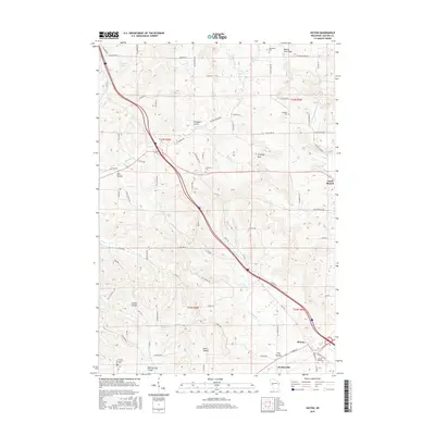
2015 Map of Hixton
USGS Topo · Published 2015About this map
The rugged drainage patterns of Jackson County define the landscape of Hixton and Sechlerville in this mid-2010s survey. The area is characterized by numerous "coulees"—deep, narrow valleys—including Ellingson Coulee, May Coulee, and Smith Coulee, which dictate the winding paths of rural infrastructure like Cheese Factory Rd. Of particular interest to local historians are several cemeteries with names that recall the region's public health struggles, such as Diphtheria Cem and Smallpox Cem located in the northern hills. High points like Mound View Rock and Chimney Rock rise above the drainage of the North Br Trempealeau River and Pigeon Cr, while the village of Hixton serves as a local hub near Tank Cr. The map preserves the specific locations of many family-named roads and landmarks, reflecting the generational agricultural layout of the coulee country.
Find a feature on this map
85 named features on this map. Tap any name to fly to it.
Don’t see what you’re looking for? This feature index may not catch every label — zoom into the map to look around manually.
Map Details
Editions of this 2015 Hixton Map
This is the sole edition of this map. No revisions or reprints were ever made.
Other maps of this area

1924 · Black River Falls
USGS Topo · 1:62,500

1926 · Black River Falls
USGS Topo · 1:62,500

1927 · Blair
USGS Topo · 1:62,500

1935 · Osseo
USGS Topo · 1:48,000

1940 · Osseo
USGS Topo · 1:62,500

1948 · Fairchild
USGS Topo · 1:62,500

1949 · Fairchild
USGS Topo · 1:62,500

1953 · Eau Claire
USGS Topo · 1:250,000

1958 · Eau Claire
USGS Topo · 1:250,000

1964 · Eau Claire
USGS Topo · 1:250,000